The North Shore municipalities in Metro Vancouver including the District of North Vancouver, City of North Vancouver and District of West Vancouver along with the Vancouver Fraser Port Authority and Squamish First Nation initiated a coordinated risk assessment and climate adaptation planning process to assess the North Shore vulnerability to sea level rise, and to identify priority areas for mitigation and risk management. The project was led by Kerr Wood Leidal Associates Ltd., a consulting firm specializing in water infrastructure engineering services for municipal development based in Burnaby. DTCI was engaged as a subconsultant to address vulnerability and risk relating to Vancouver Fraser Port Authority properties on the North Shore, and to estimate potential economic impacts of disruptions to the goods movement system.
The assessment of the potential economic impacts of coastal flooding for North Shore port-related industries was based on a methodology developed for the U.S. Transportation Research Board (TRB). The TRB study developed a robust methodology for estimating the impacts of disruptions and delays to the goods movement system which takes into account spatial scale, duration, supply chain resiliency and interdependencies among businesses.
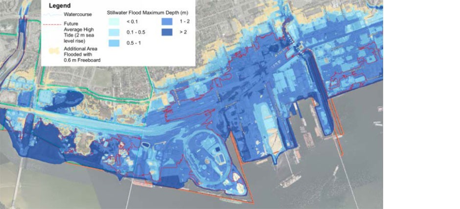
DTCI conducted interviews with all port facility operators in coordination with the Port of Vancouver Engineering and Environment departments to gather information on current terminal operations, planned investments and potential impacts of flooding events based on detailed flood maps for three scenarios ranging from .5 metres to 2 metres of sea level rise.
The full DTCI report is available on the District of North Vancouver website as Appendix E of the North Shore Sea Level Rise Risk Assessment & Adaptive Management Strategy here.